
Laser scanning for architects on 1st Rabochaya St.
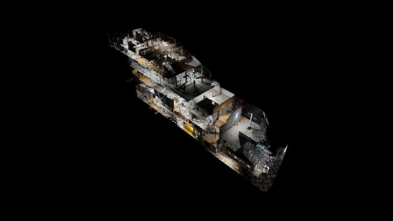
Interactive 3D tour: real dimensions and proportions of the object, inspection in the browser from any device.
About the project
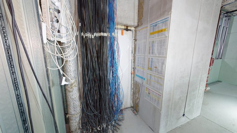
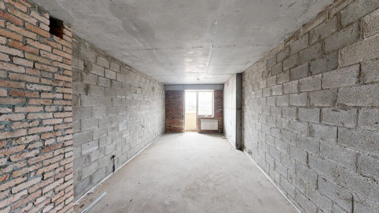
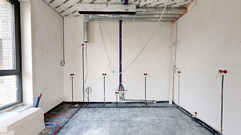
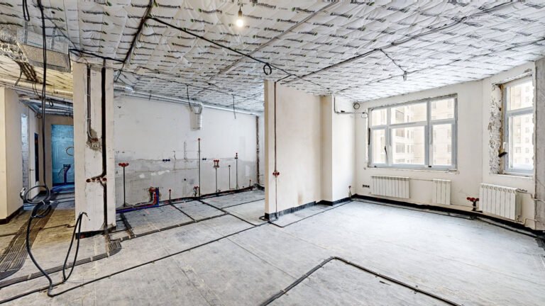
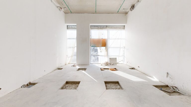
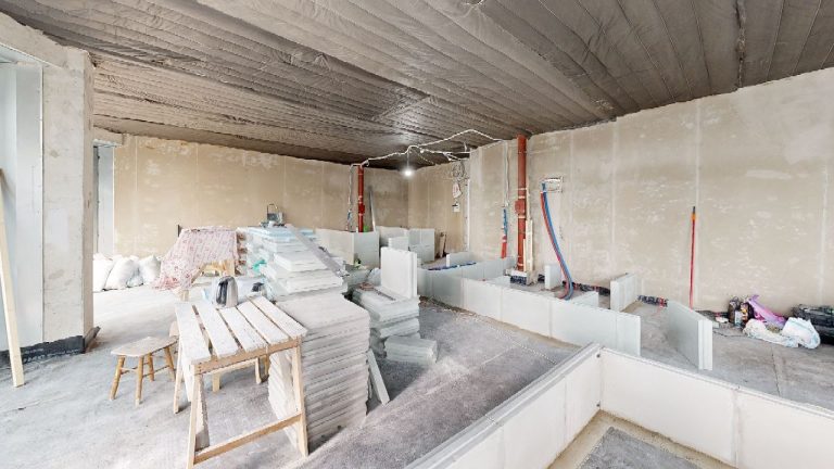
Do you think laser scanning is difficult and expensive? Drop the stereotypes! We will show how modern Matterport PRO 3 technologies simplify the work of architects, builders and developers using the example of a real object on 1st Rabochaya Street. Forget about manual measurements and endless site visits. With a 3D tour, you can instantly get an exact digital copy of the room, take measurements, create floor plans, and even “walk” through the facility without leaving your office. It's not just convenient, it's a new standard of efficiency in design and construction. Judge for yourself how Matterport PRO 3 copes with the task: high detail, millimeter accuracy and the ability to work with data in a format convenient for you. Look into every corner, check complex components and discuss the project with colleagues using a single 3D model. Make sure the future is here and it will make your job a lot easier.
Filming technology
Matterport Pro 3
Laser LiDAR scanning: the tour conveys real dimensions and proportions - it is a digital twin of the object, and not a set of photographs.
Shooting in 1–3 days
The object is removed without stopping work. More than 900 filmed projects throughout Russia.
Three placement formats
Cloud 360° Space, your server or offline version. The tour is embedded on the website, in Yandex.Maps, 2GIS and social networks.
Where is the object located?
The object was filmed in the city of St. Petersburg. We shoot all over Russia: the team travels to any city, it takes 1-3 days to get to the location.
Why a 3D tour is useful for architects and restorers
Measurements without visiting
Distances and dimensions are measured directly on the tour - fewer repeat visits to the site.
Fixing the state
Documentation of the building “as is” before the start of work is the basis for the project and designer’s supervision.
Whole team work
The tour opens via a link in the browser - designers, customers and contractors see one object.
Foundation for CAD and BIM
The point cloud from the survey transfers the real geometry of the building into the design environment.
Frequently asked questions
How much does such a 3D tour cost?
Basic tours - from 15,000 ₽, the final price depends on the area of the object and options. Calculates the exact cost online calculator - no calls or waiting.
How long does filming take?
Filming takes 1–3 days, depending on the area, without stopping the work of the facility. Ready tour - within a week.
Where can I place the finished tour?
On the website, in Yandex.Maps and 2GIS cards, in social networks. Three hosting formats: our cloud, your server or offline version without the Internet.
How accurate are the measurements in the 3D tour?
Matterport Pro 3 scans the space with a laser LiDAR sensor - sufficient accuracy for preliminary measurements and preliminary design. For working drawings, point cloud export is ordered.
Is it possible to get a point cloud or BIM model?
Yes. Point cloud (E57) and BIM model are additional options, their cost is calculated in calculator.
Is it possible to update the tour after changes?
Yes. Reshooting individual areas is cheaper than a full shoot - the tour is kept up to date.
Similar Projects
Order a 3D model for architecture and restoration
Leave your contact — we'll respond within 30 minutes and calculate the cost
We use cookies and analytics services to make the site work better. By continuing to use the site, you agree to cookie policy And privacy policy.